Close


Home » Explore » Routes and itineraries » Hiking Trails » 16 – Ridge Loop
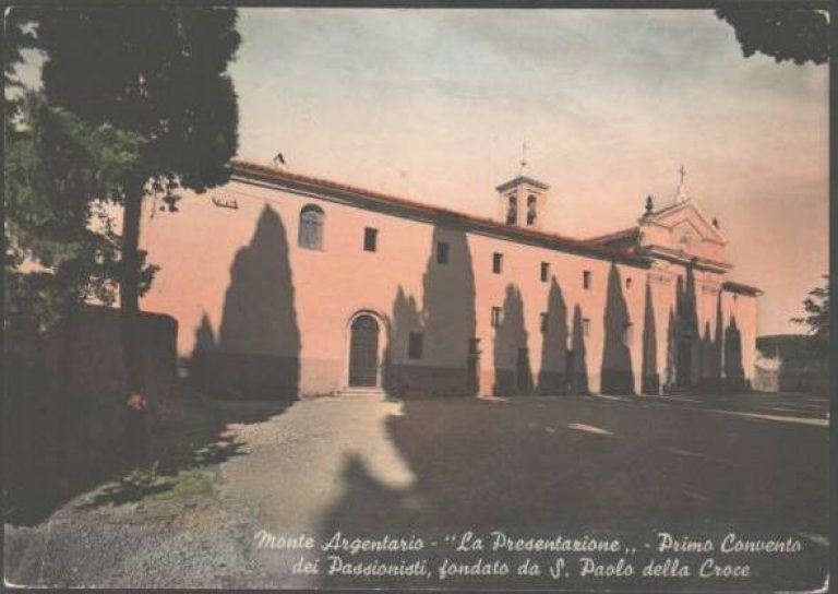
Starting point: The square in front of the Passionist Monastery
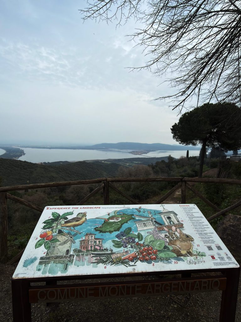
Convent Square, where the “Experience the Landscape” sign is located
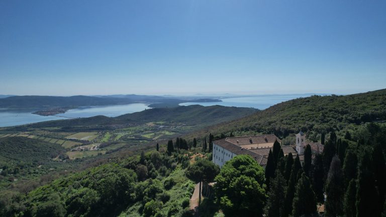
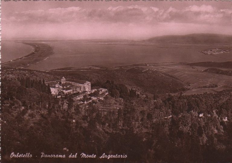
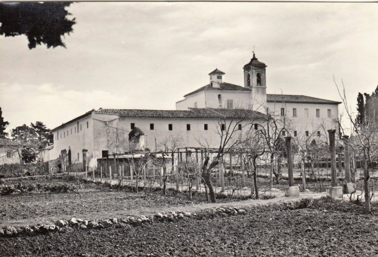
Let's start at the square in front of the Passionist Convent, at 273 meters above sea level, in one of those places that seem tailor-made for pausing a moment before setting out. The convent before us—formally the Presentation in the Temple — has a history that began in 1722, when a young Piedmontese priest named Paolo Danei traveled through these woods on a journey to Rome and was struck by the tranquility of the promontory. He returned six years later to ask permission to settle in a small abandoned hermitage dedicated to Saint Anthony. Legend has it that it was St. Paul of the Cross himself who marked out the perimeter of the convent with a stick on the ground before work began. The cornerstone was laid in 1733, and the building was inaugurated in 1737: from that moment on, this place onArgentario the motherhouse of the Passionist Fathers, a congregation now present in over fifty countries around the world. In 2000, John Paul II stopped there for a surprise prayer, without warning, much to the delight of the religious present. Before leaving, it’s worth taking a stroll to the left side of the square, where an illustrative watercolor panel — part of the “Experience the Landscape” developed by Studio Ecista in collaboration with the argentarioturismo.it portal — is located at a scenic viewpoint overlooking the Orbetello Lagoon and the tombolo of Giannella: a first overview of the area we are about to traverse on foot.
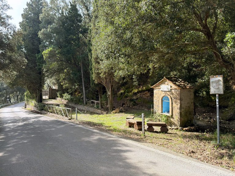
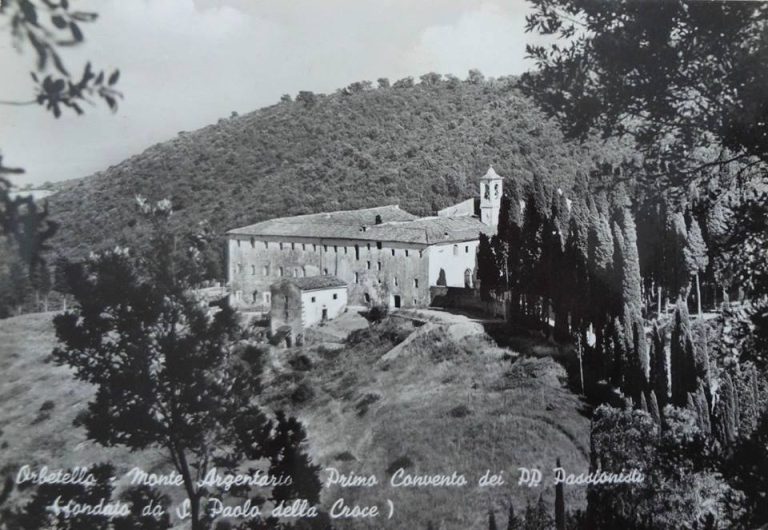
The Retreat of St. Joseph: the saint’s second monastery
Turn here for the San Giuseppe Retreat
As you walk up the paved road, just off the path on the right, you can catch a glimpse of the San Giuseppe Retreat, the second convent commissioned by St. Paul of the CrossArgentario. The story of its founding is almost a practical solution to a concrete problem: the Convent of the Presentation, located further down, suffered from dampness, and the saint sought a sunnier location to house the novices. He found it in November 1753, during a visit to the community: here too, as he had done twenty years earlier, he traced the perimeter of the church and the retreat on the ground with his staff. The work was completed in 1761, when the first novices arrived. While the Presentation faces Orbetello and the lagoon, San Giuseppe faces Porto Santo Stefano and Talamone — the two convents, about 800 meters from each other, seem to hold the promontory between two gazes. Today, the retreat is no longer permanently inhabited, but it is kept in excellent condition thanks to the work of numerous volunteers, and continues to welcome those seeking a place of silence and reflection.
The path to the antennas and the view that unfolds
Viewpoints
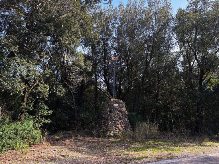
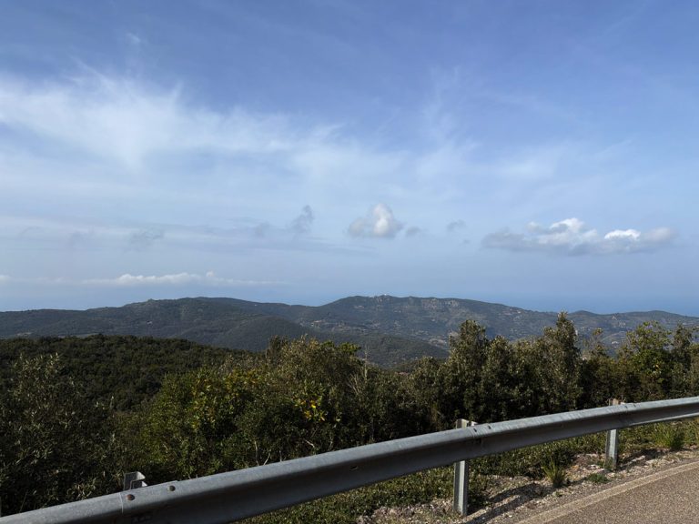
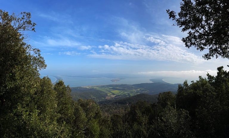
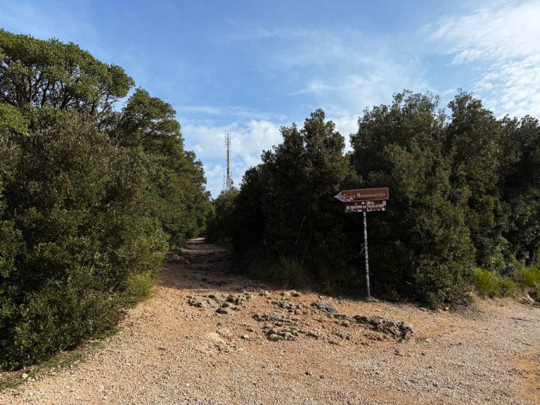
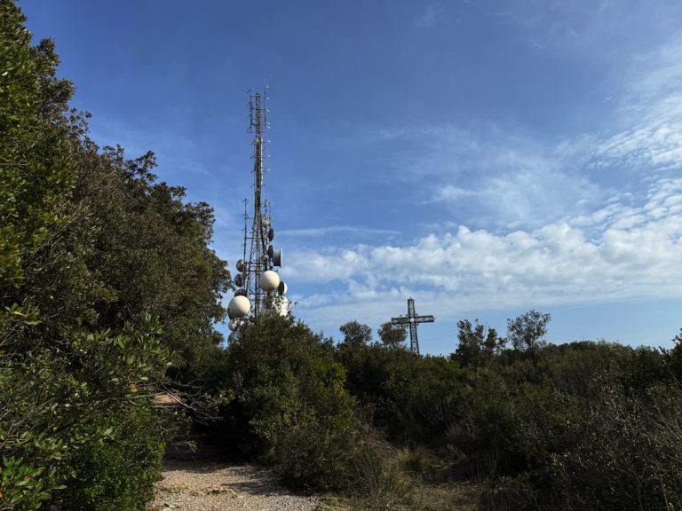
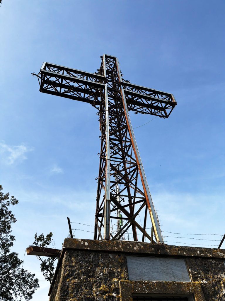
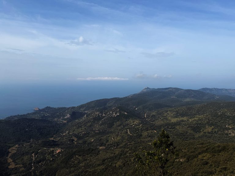
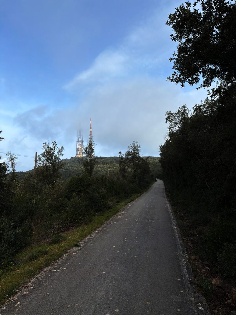
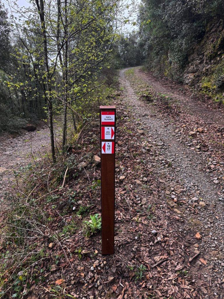
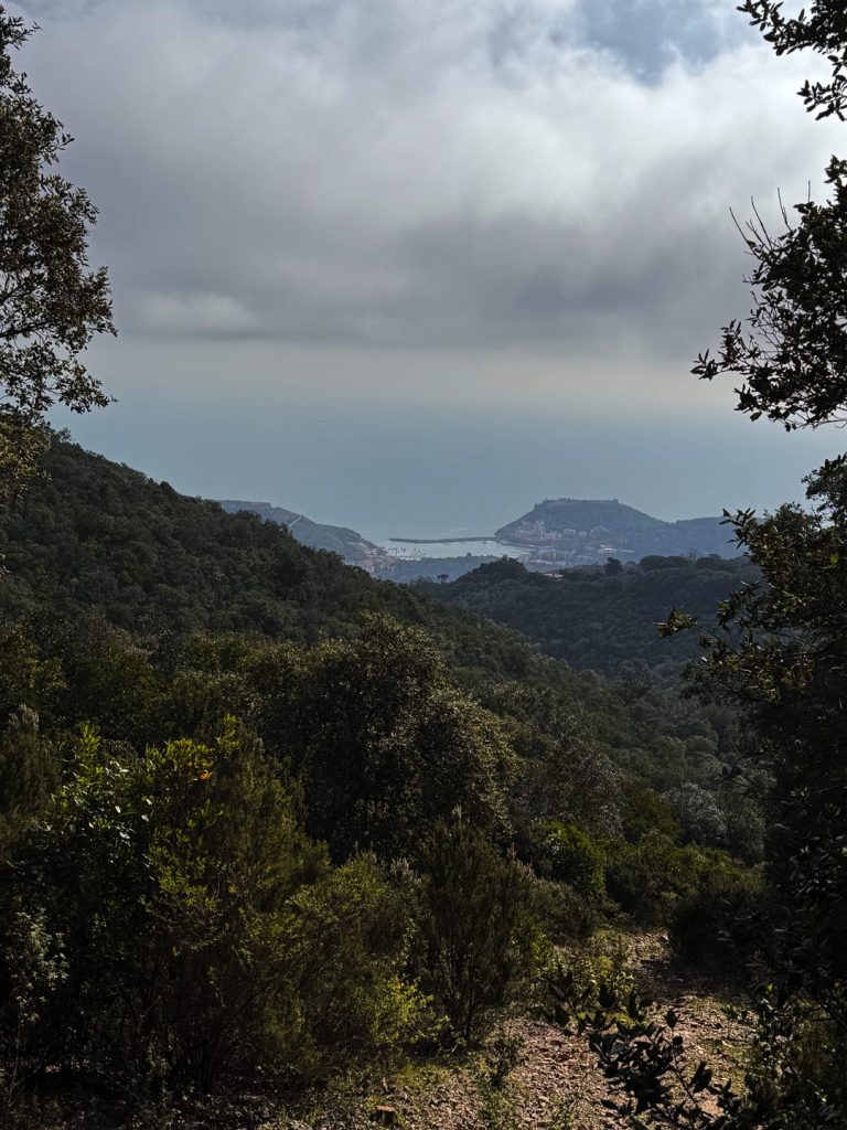
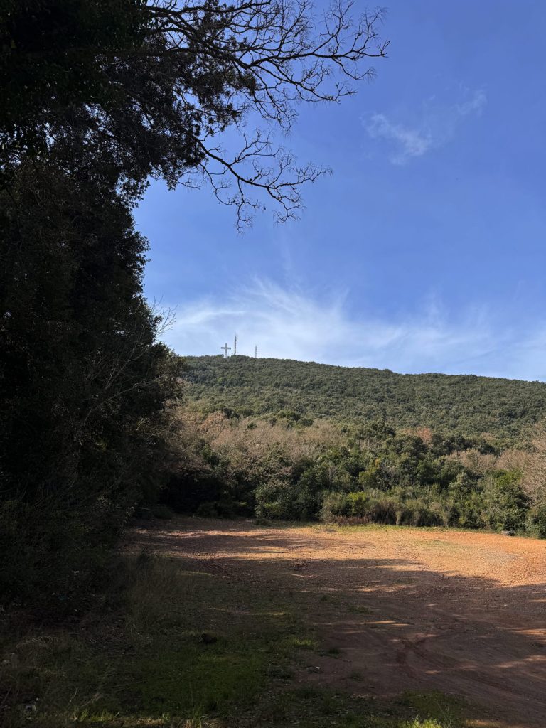
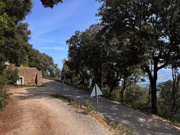
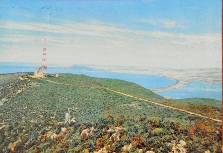
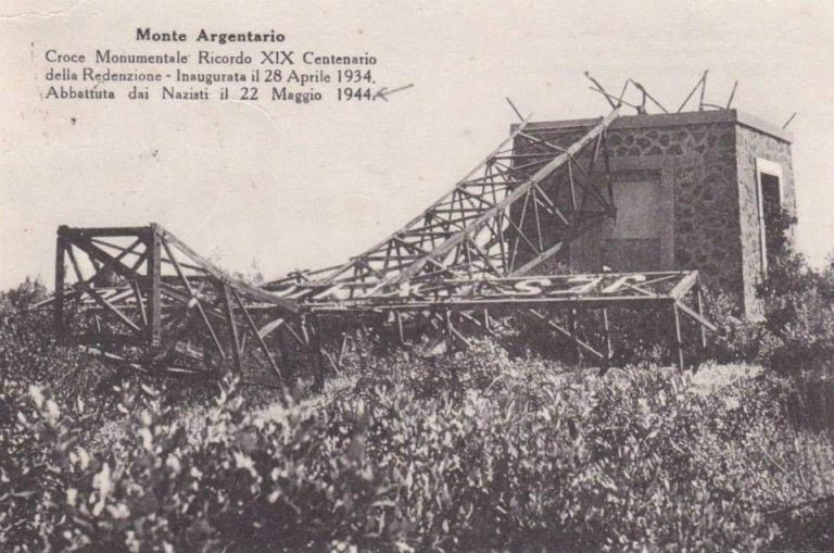
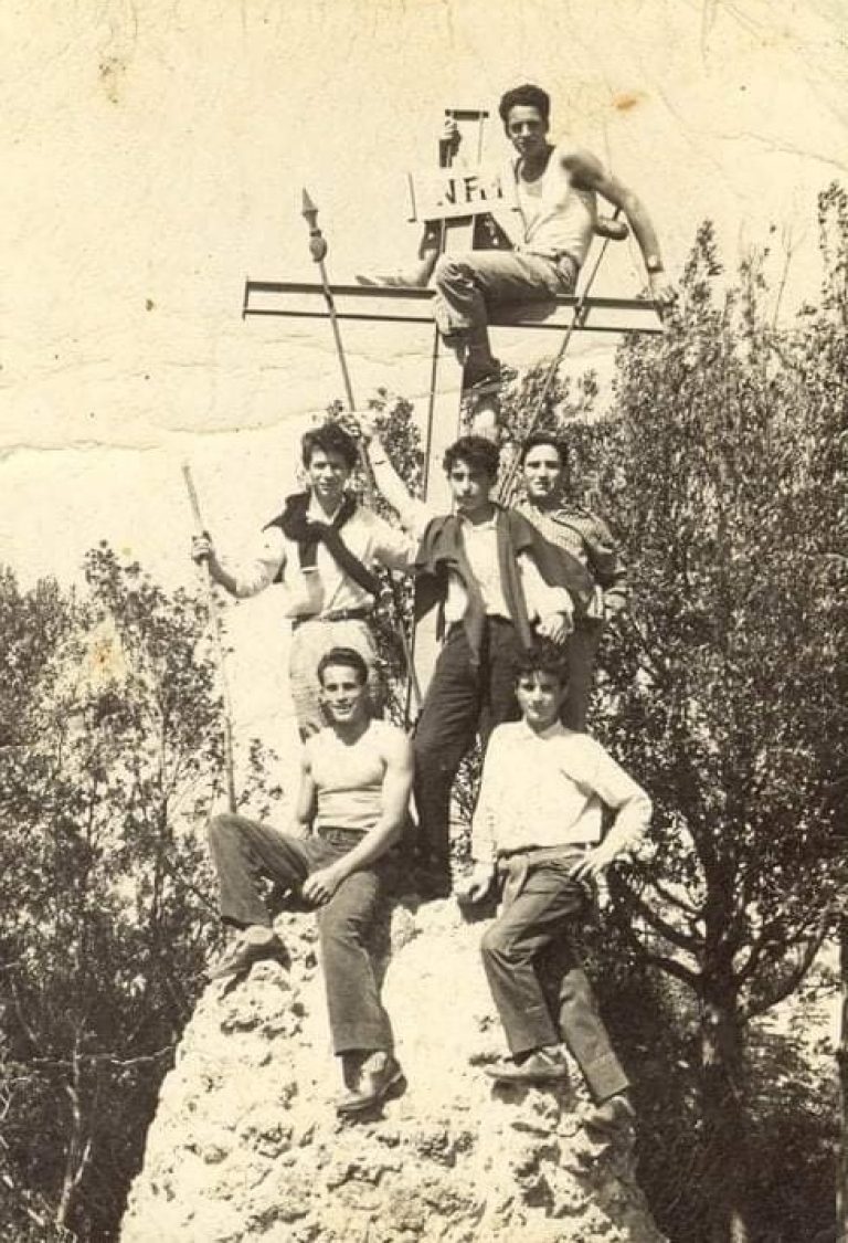
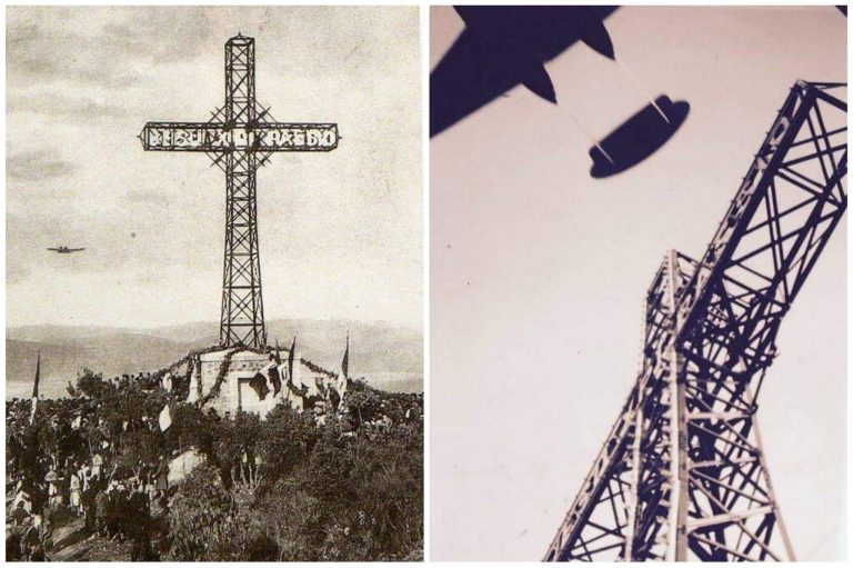
Continuing along the paved road , we gain elevation with an increasingly open view on both sides. As we climb, the Orbetello Lagoon spreads out to the left like a mirror nestled among the tombolos, while to the right the Tyrrhenian Sea stretches toward the horizon with theIsola del Giglio and theIsland of Giannutri becoming increasingly clear. Along the way, not far from the road, you can see the Monumental Cross: built in 1934 at the behest of the Passionist Fathers and the local population, it was destroyed by Allied bombing in 1944 — when Monte Argentario the second-most heavily bombed Italian municipality after Cassino — and rebuilt on the same foundation in 1948. We thus arrive near the antennas and the Air Force weather station of the Italian Air Force, structures that crown the secondary summit and can be seen from afar as visual landmarks from the entire coast. We are at the threshold of the actual summit: Punta Telegrafo at 635 meters, which takes its name from a semaphore tower built by the the French during the Napoleonic era to transmit light signals along the Tyrrhenian coast. The tower was demolished in the 1960s precisely to make way for these installations, but the name has remained—and has become the name of the entire mountain.
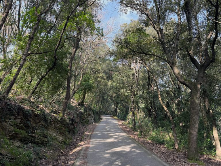
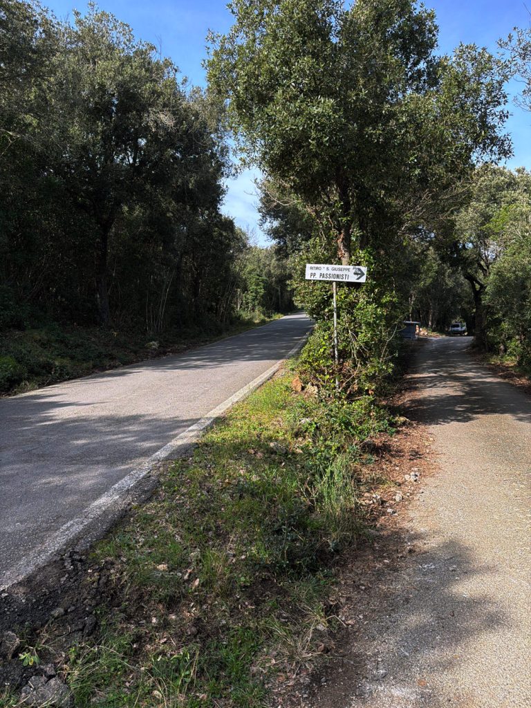
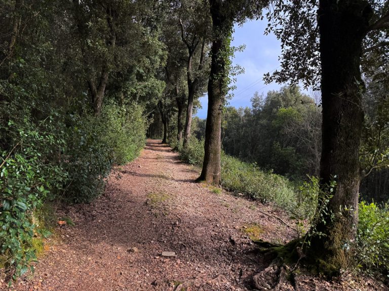
The San Mario Road: where the pavement ends and the woods begin
End of the paved road, beginning of the dirt road
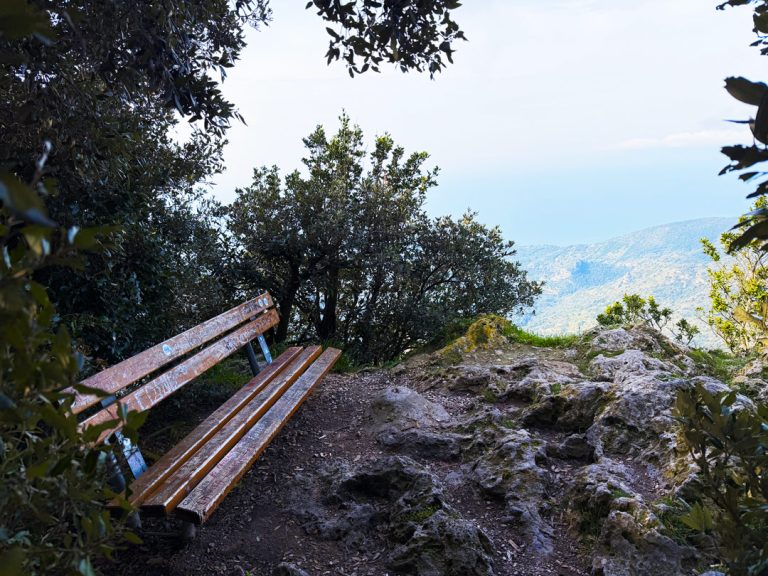
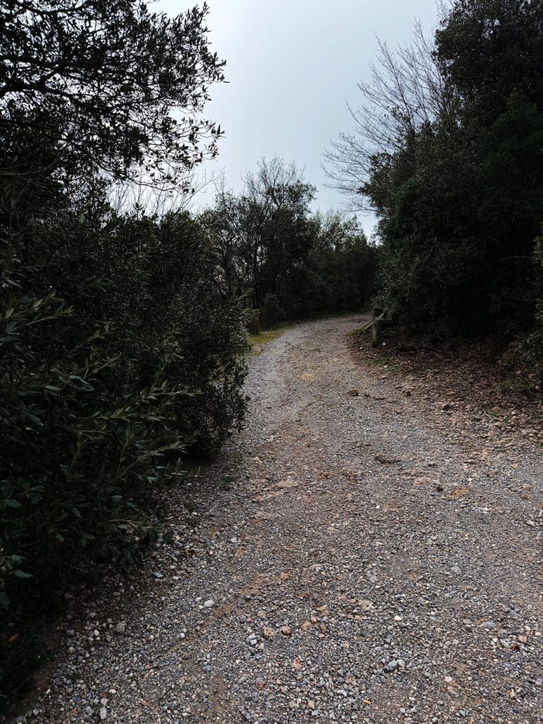
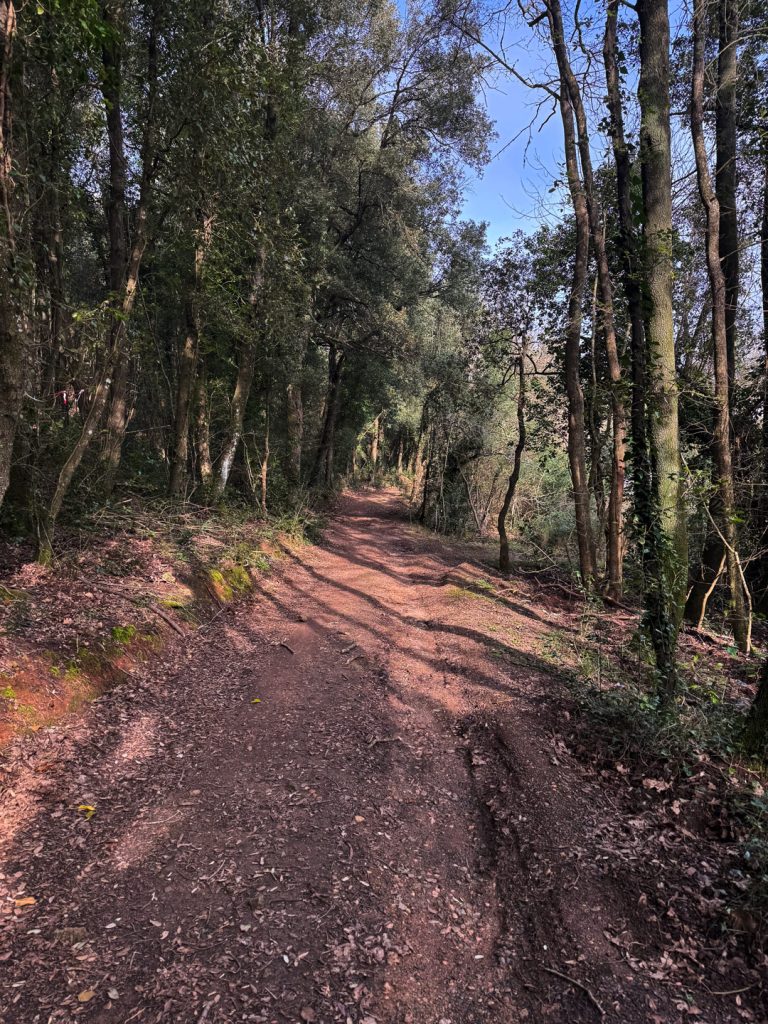
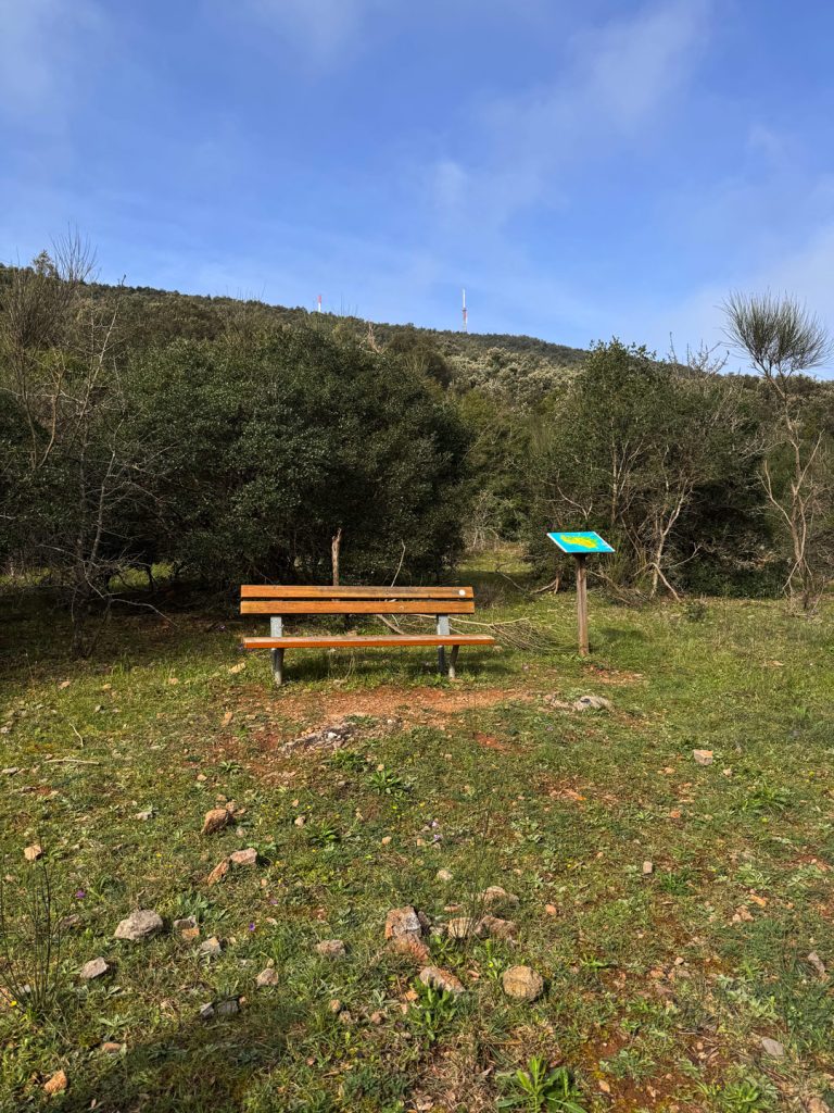
Once past the antenna area, we turn onto San Mario road: a dirt road, through the woods, quiet. The change of scenery is stark and immediate. A few steps and the asphalt is already a distant memory. Immediately on the right we find theRest Area of the : benches, tables, and a: benches, tables, and an illustrated panel featuring drawings by Carlo Rispoli, a cartoonist and illustrator from Grosseto who collaborated with Studio Ecista on the project, depicting the flora, fauna, history, and cultureArgentario. The illustrations portray the promontory from an unusual perspective, halfway between a nature guide and a comic book, and offer a valuable insight into everything around us. Along the sides of the trail stand holm oaks, strawberry trees, phyllirea and mastic, and in the fall, the strawberry tree produces both white flowers and red fruits on the same plant. An unexpected botanical curiosity: among the typical Mediterranean scrub, one can also find some chestnut (Castanea sativa), trees you wouldn’t expect in this coastal setting. Their presence is almost certainly a sign of a historic plantation — likely the work of monks or farmers who once worked these lands — who cultivated this tree for its precious fruit, known for centuries as “breadfruit tree”.
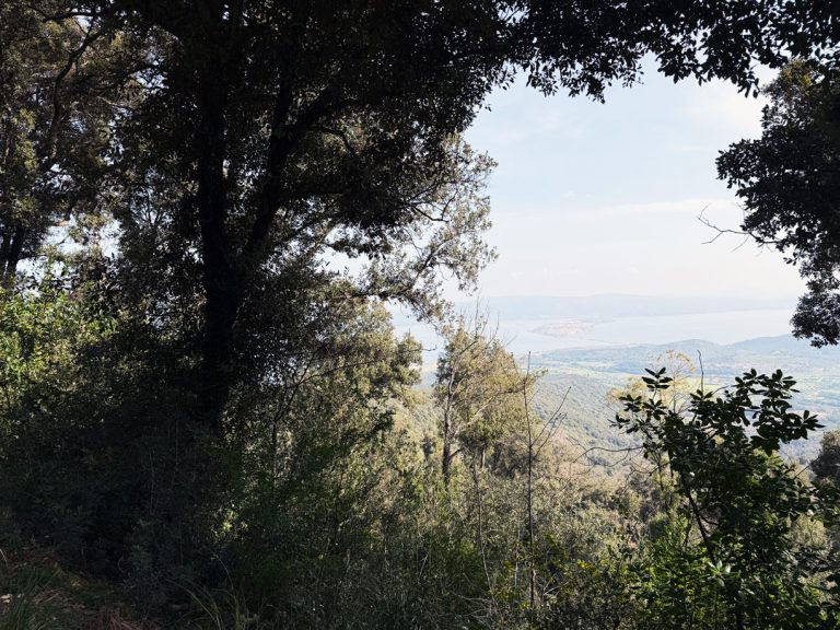
The fork in the road and the descent toward the west side
After about 1.5 km
Continuing along San Mario Road, we come to a fork in the road: to the left, the trail descends westward, entering the woods covering the inner slope of the promontory. It is here that a small botanical surprise awaits us: among the dominant Mediterranean scrub, a few chestnut (Castanea sativa), trees you wouldn’t expect in this coastal setting. The chestnut tree thrives in acidic soils and cooler, more humid climatesArgentario a far cry from the typical vegetationArgentario and their presence is almost certainly a sign of a historic plantation, likely the work of the friars or the farmers who once worked these lands. For centuries, this tree has been called “bread tree” because of the extraordinary nutritional value of its fruit, capable of feeding entire populations during times of famine. Finding a few here, hidden among the holm oaks and arbutus trees, is like reading a footnote in the history of this promontory. From some clearings, meanwhile, the view opens up onto the Orbetello Lagoon and the two tomboli — the Giannella and the Feniglia — which connect the promontory to the mainland.
A forgotten story on the edge of the woods
Just before reaching the square
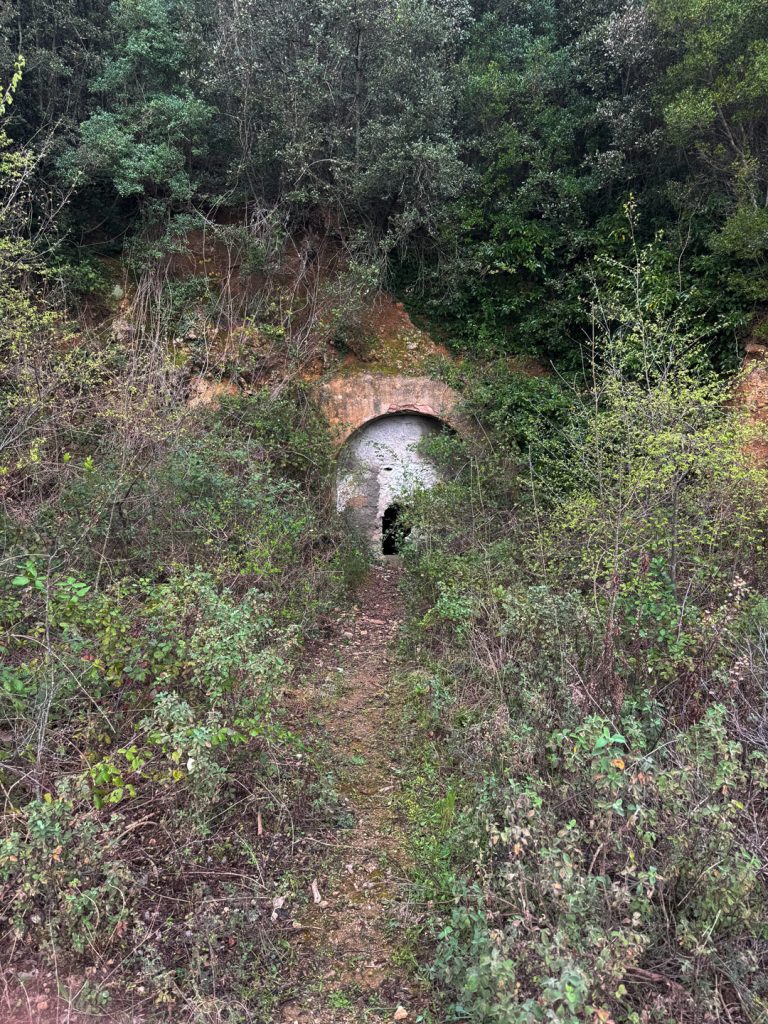
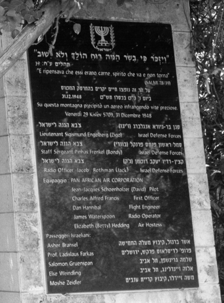
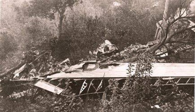
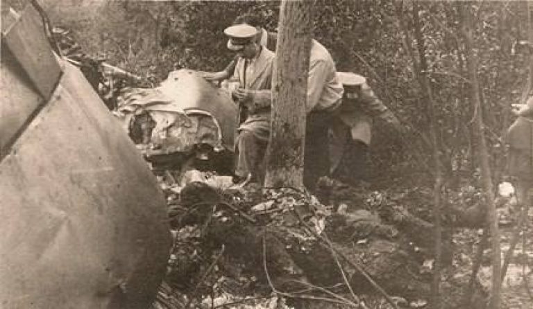
Continuing through the woods on the eastern slope, we are approaching a place that holds a story that is almost unknown. The December 31, 1948, in the late afternoon, a transport plane crashed into these slopes not far from the Passionist Monastery. There were thirteen people on board: Israeli passengers, soldiers, and the crew. The plane had come from Tel Aviv and was heading north, but the pilot—disoriented by thick fog, the falling darkness, and perhaps misled by the Orbetello Lagoon , which he mistook for the open sea—did not realize that the mountain was ahead of him. No one survived. Among the victims was Professor Farkas Ladislaus, one of the founding fathers of science in the nascent State of Israel. According to sources, a small bilingual commemorative plaque, in Italian and Hebrew, was placed at the crash site. The mountain still guards it, silently, among the trees.
The circle is complete: the promontory seen from the inside
Arrival at the convent
On the way back to the convent square along the final stretch of asphalt, the loop closes, and we can look back with a perspective we didn’t have at the start. We’ve traversed one of the most fascinating geographical features of the Tuscan coast: a promontory that was once antrue island, separated from the mainland, and which was connected to the coast by human intervention—and not, as the legend says, by debris carried by rivers further north—forming the two sandbars — the Giannella and the Feniglia — and in the middle, the Orbetello Lagoon. The name itself, Argentario, carries with it a history that is still debated: according to the most widely accepted tradition, it derives from the Roman family of the Domizi-Enobarbi, also known as the argentarii — the bankers of ancient Rome — who received the promontory as compensation for loans granted during the Second Punic War. WalkingArgentario , in essence, walking on a place that has always held value—strategic, spiritual, economic—for anyone who has gazed upon it from the sea.
To provide the best possible experience, we use technologies such as cookies to store and/or access information on your device. By consenting to these technologies, we may process data such as your browsing behavior or unique identifiers on this site. Failure to consent or withdrawal of consent may adversely affect certain features.